 |
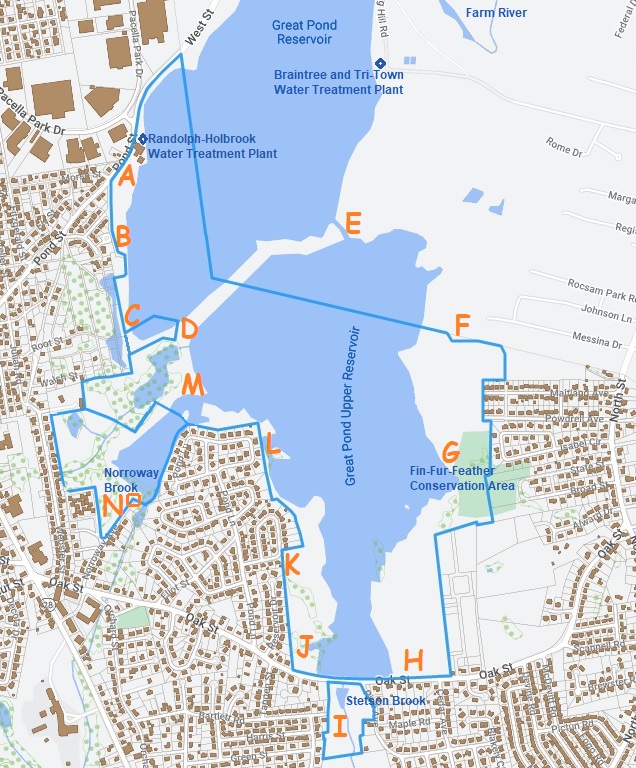
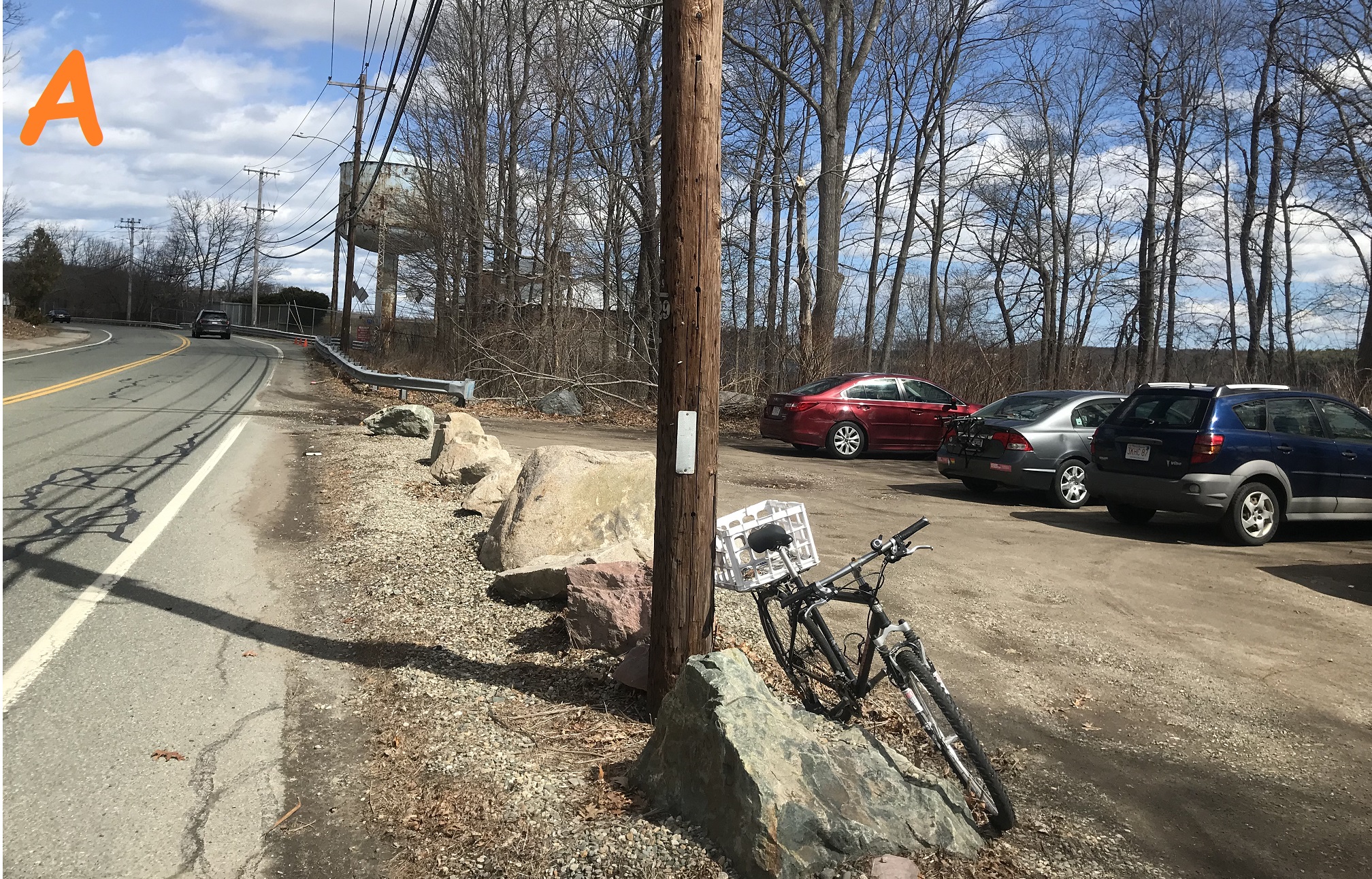
Point A facing east: Reservoir Walk Pond Street parking area
There's a parking lot on Pond Street which is the north entrance to the Reservoir Walk.
The parking lot isn't well marked but is just west of the Water Treatment Plant's "rusty tower" seen in the distance.
The Water Treatment Plant is fenced off but that road (Pond Street becomes West Street in Braintree) goes to Braintree center and the South Shore Plaza. That rusty water tower will be phased out in about 2025 when the new Tri-Town Water Treatment Plant opens.
|
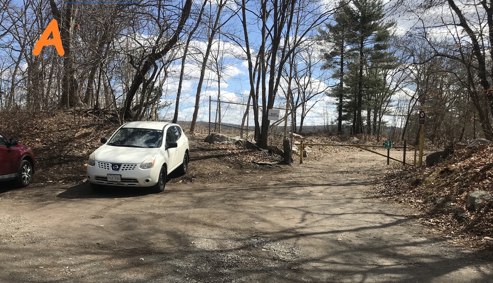 |
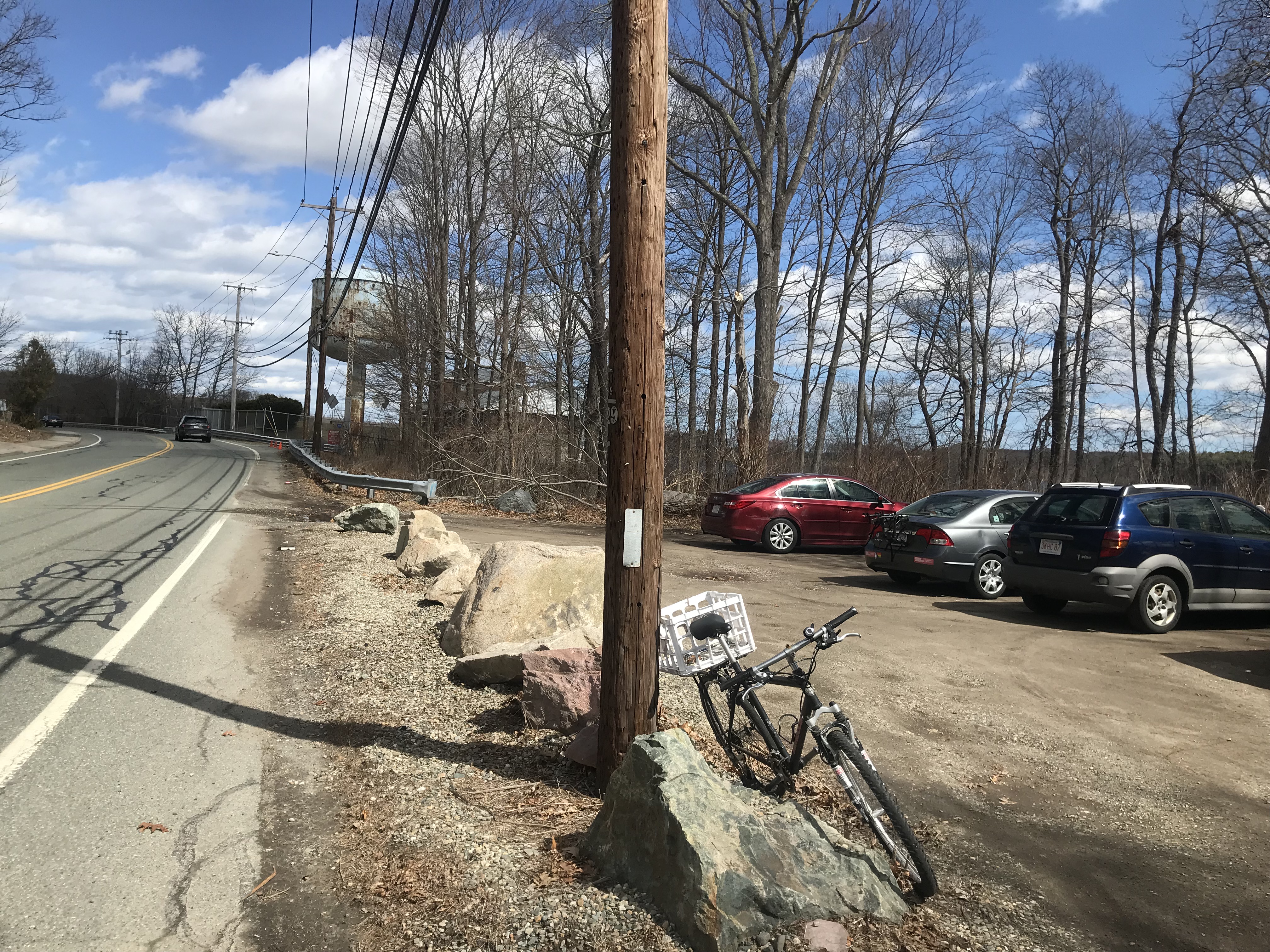
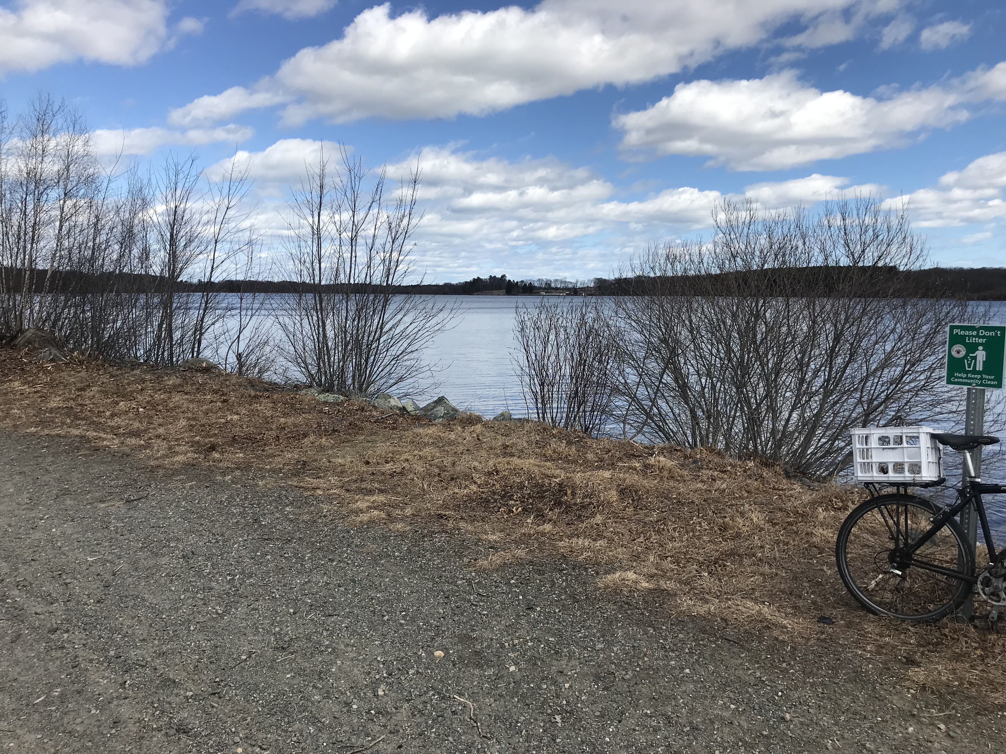
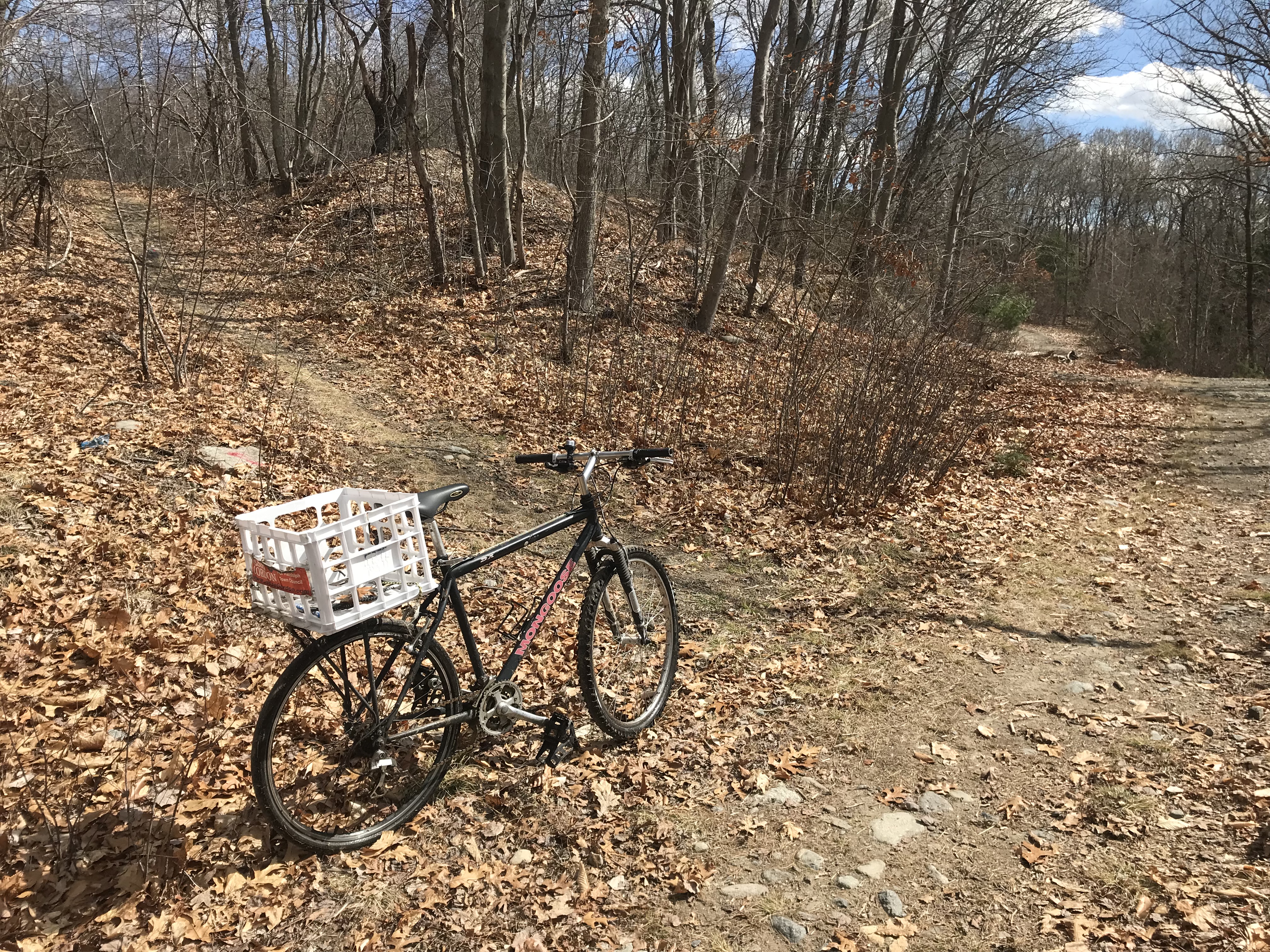
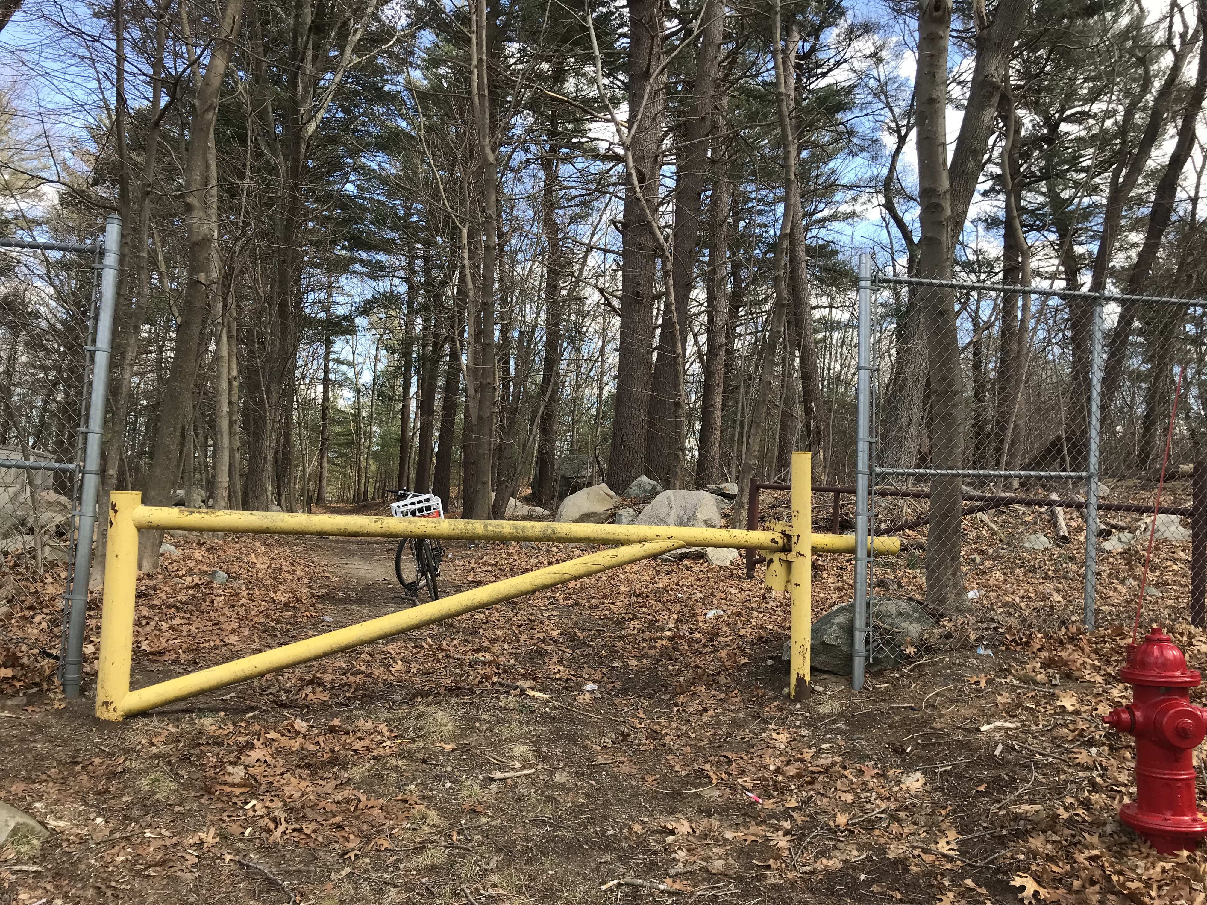
Point A facing south: Reservoir Walk north entrance
From the same point, looking south, is the entrance to the Reservoir Walk. The "Welcome Sign" will be placed between the white car and the vehicle gate.
That vehicle gate is to keep cars out of the Reservoir Walk -- the DPW opens it to bring in maintenance vehicles.
It is not intended to keep out pedestrians or bicyclists or people walking their dogs -- all are welcome!
Most people walk or bike behind the white car up the little hill around the fence.
If there's not enough parking here, please try Pacella Park Drive instead of blocking the entrance or parking on Pond Street.
|
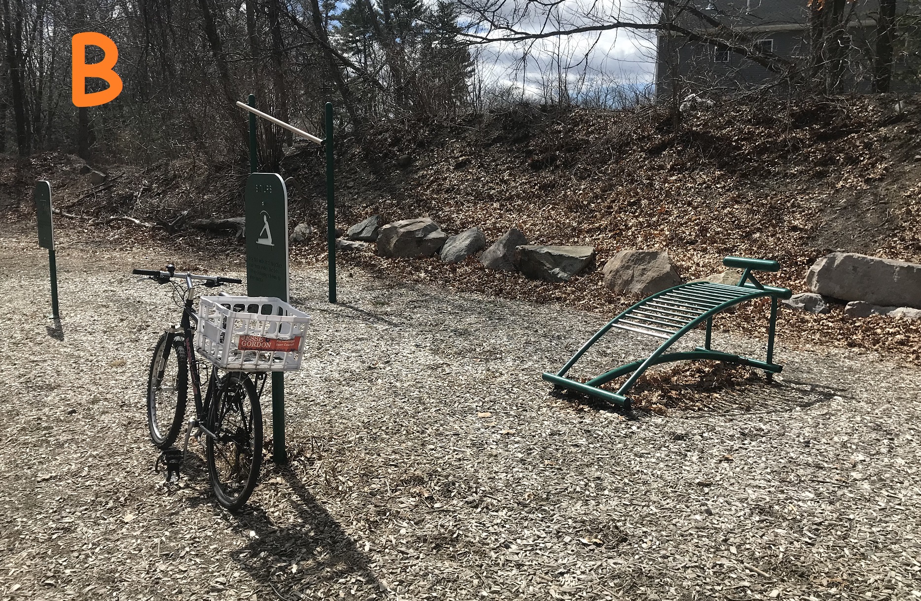 |
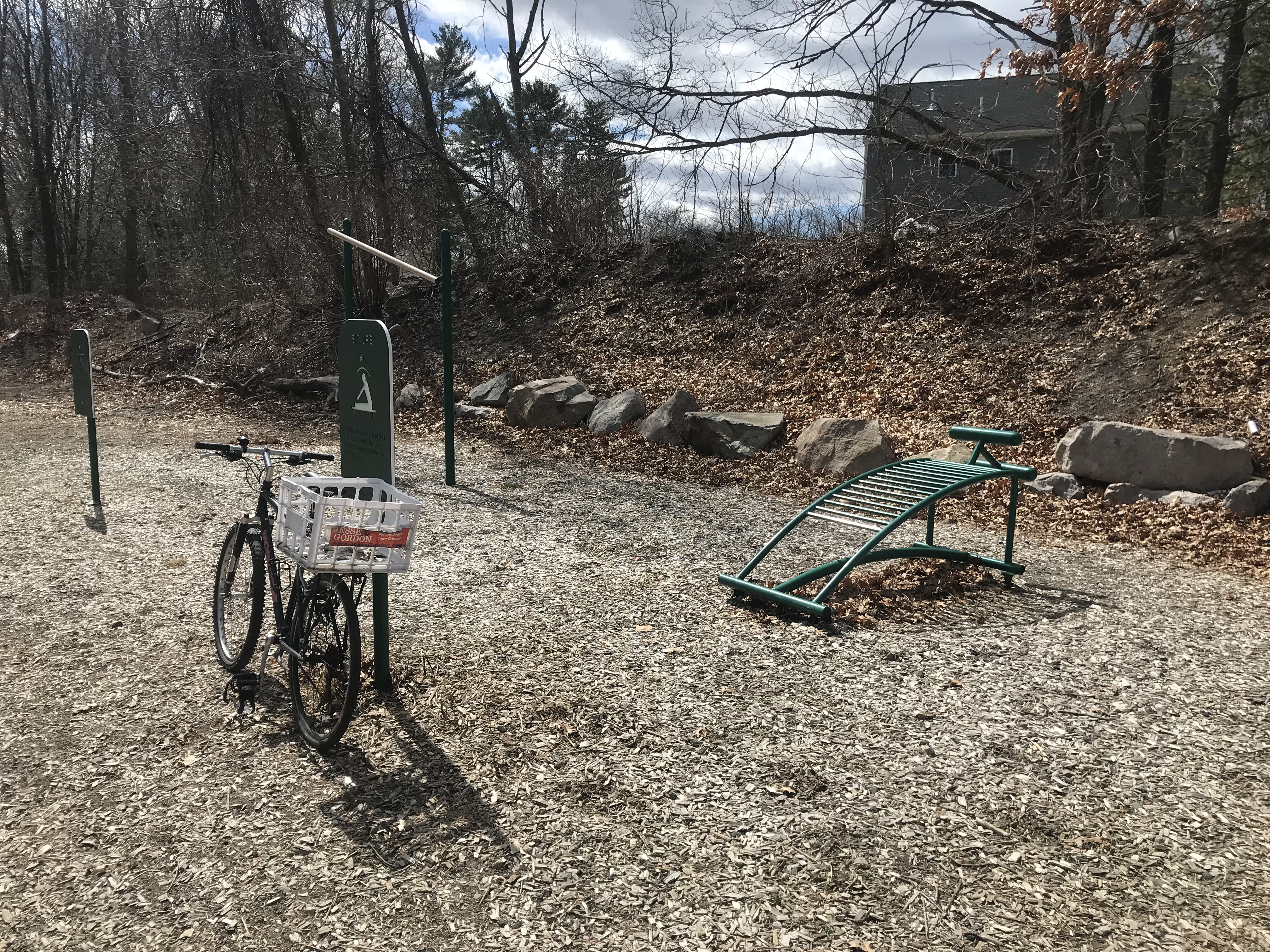
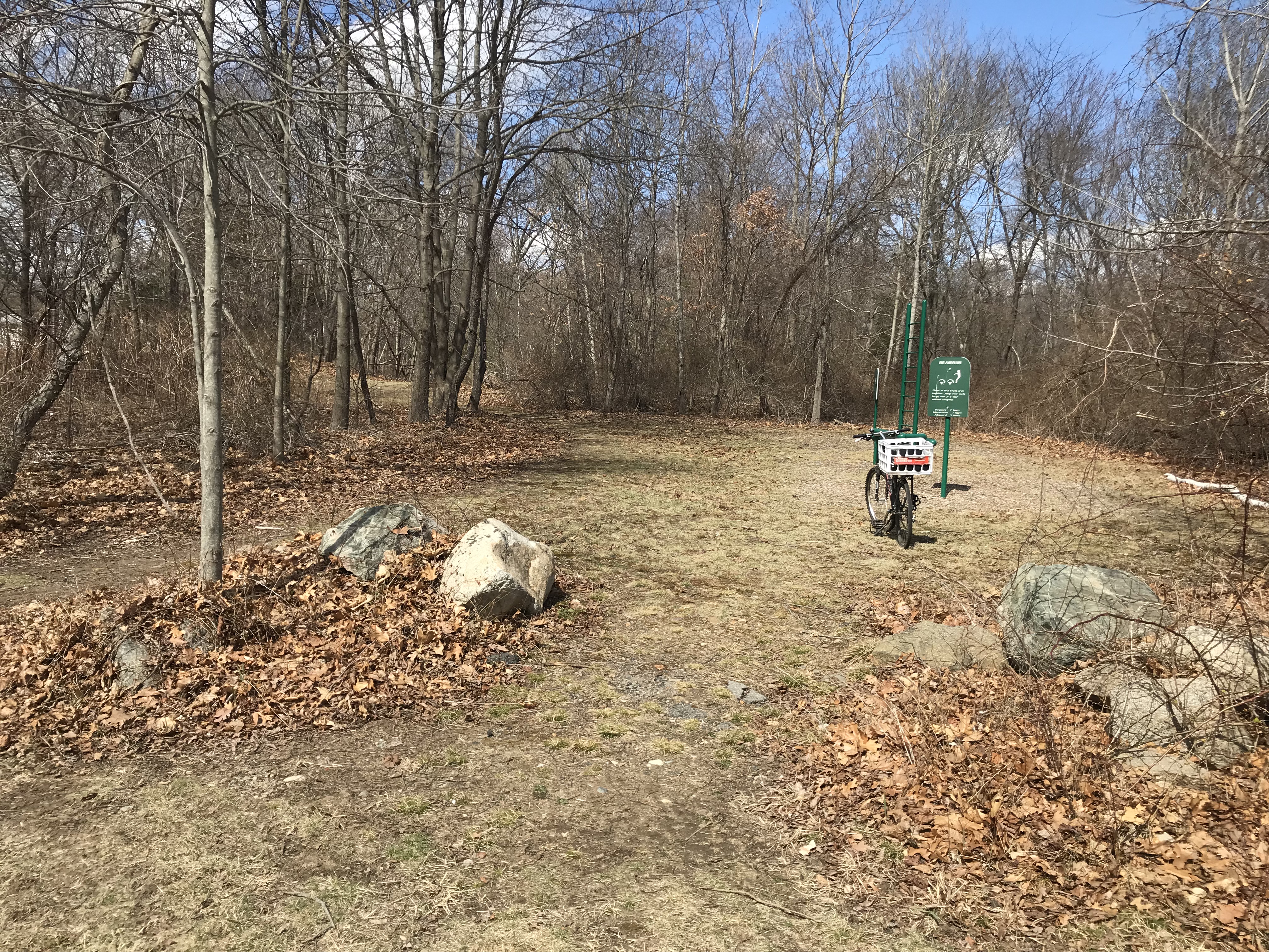
Point B: north Workout Area
There's a "workout area" along the Reservoir Walk near the Pond Street entrance. There's another workout area near Oak Street at point J. Both are maintained by the Randolph DPW (as are the parking areas and the Reservoir Walk trails themselves).
|
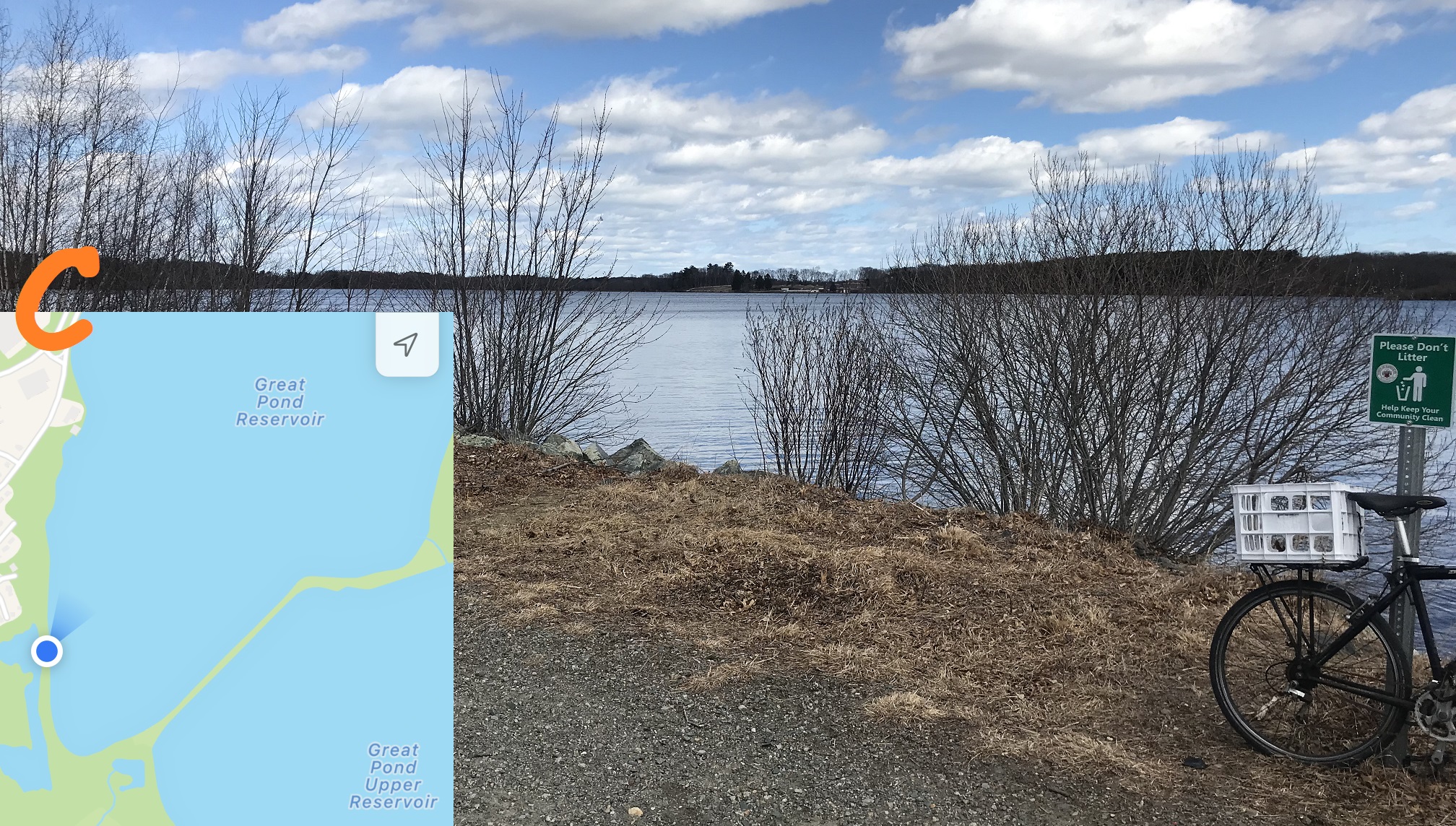 |
Point C: View north across Great Pond Reservoir
Just north of the dam, looking northeast, you can see the Braintree Water Treatment Plant. This plant will be decommissioned in about 2025 when the new Tri-Town plant is completed, just north (to the left ni the photo).
Many people have asked to allow access to the new Tri-Town plant as an educational resource (such as for school tours, as is done with at other modern water treatment facilities). That decision will be made in 2023 or 2024, and your input on this issues to the Randolph Town Council and the Braintree Town Council would be valued.
|
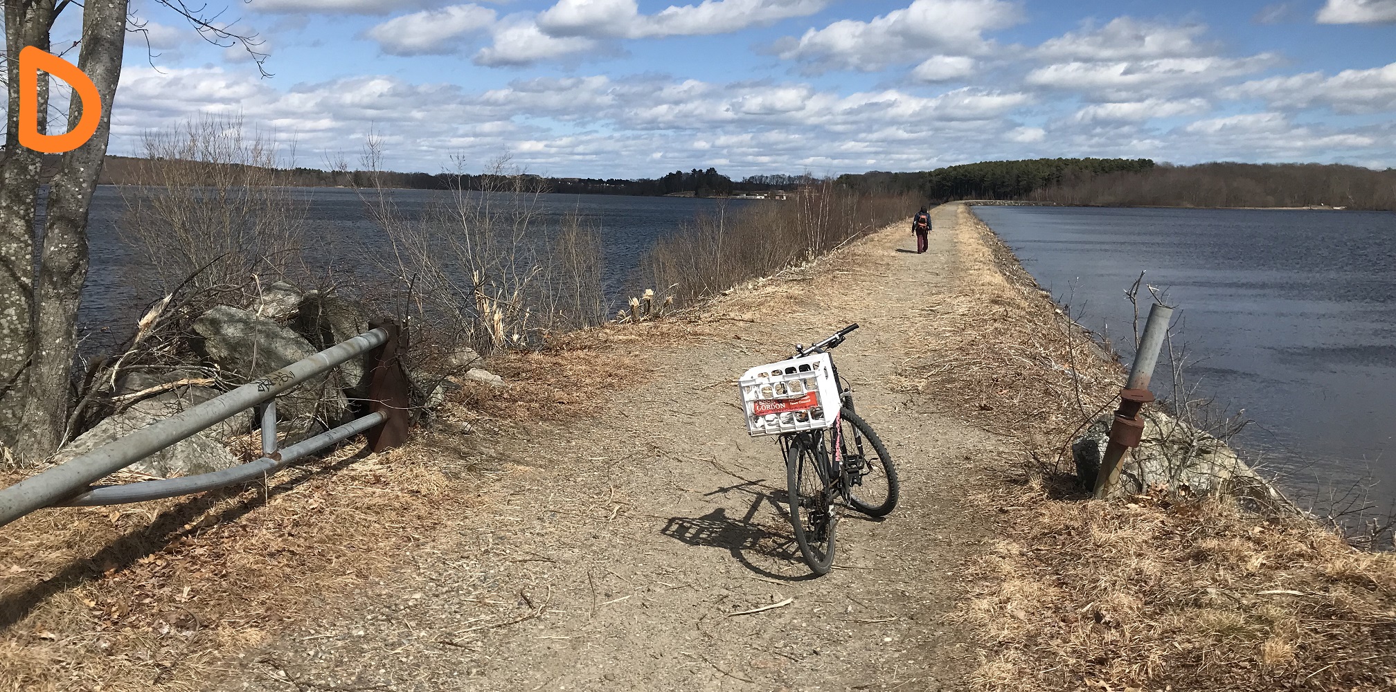 |
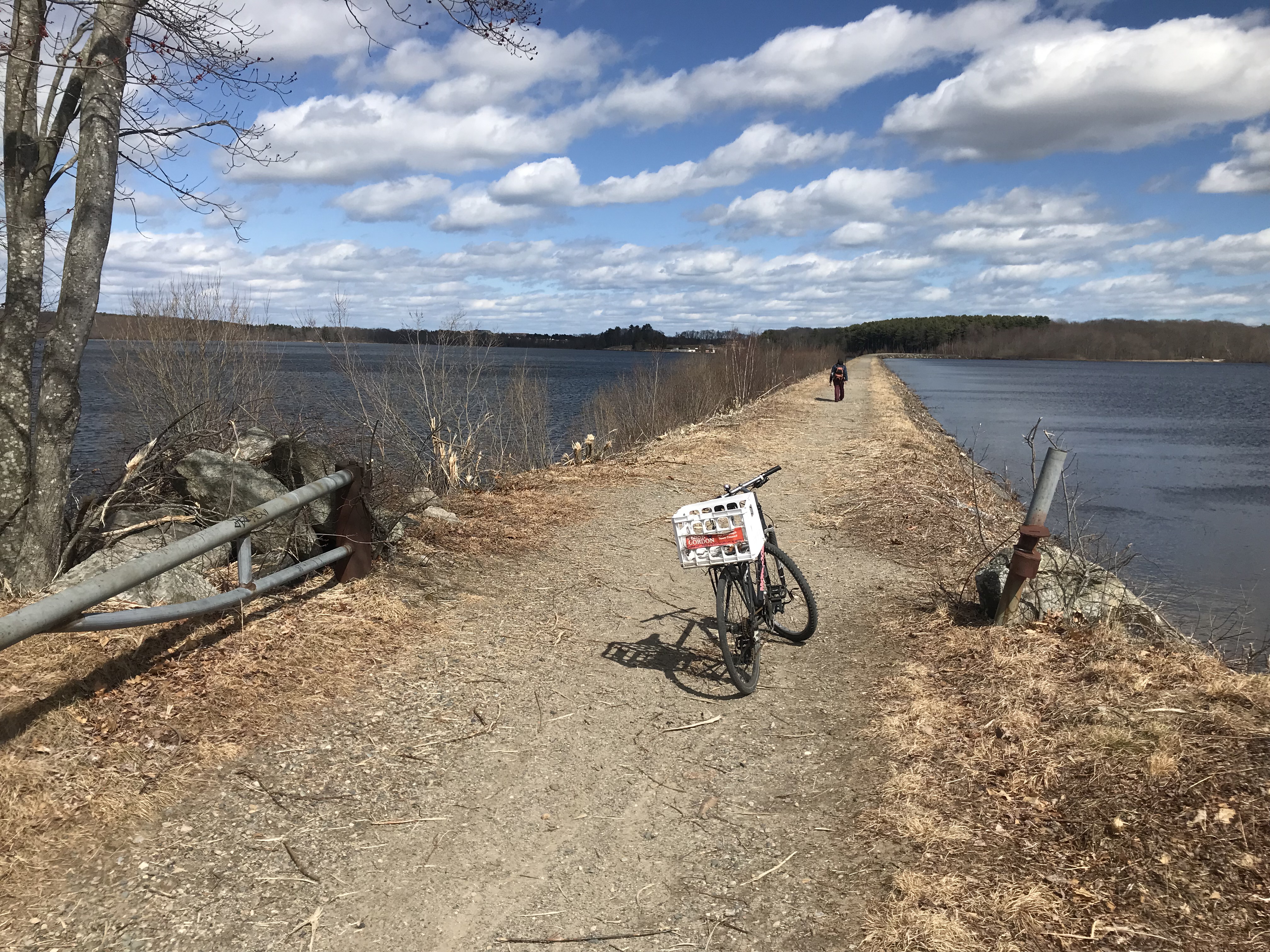
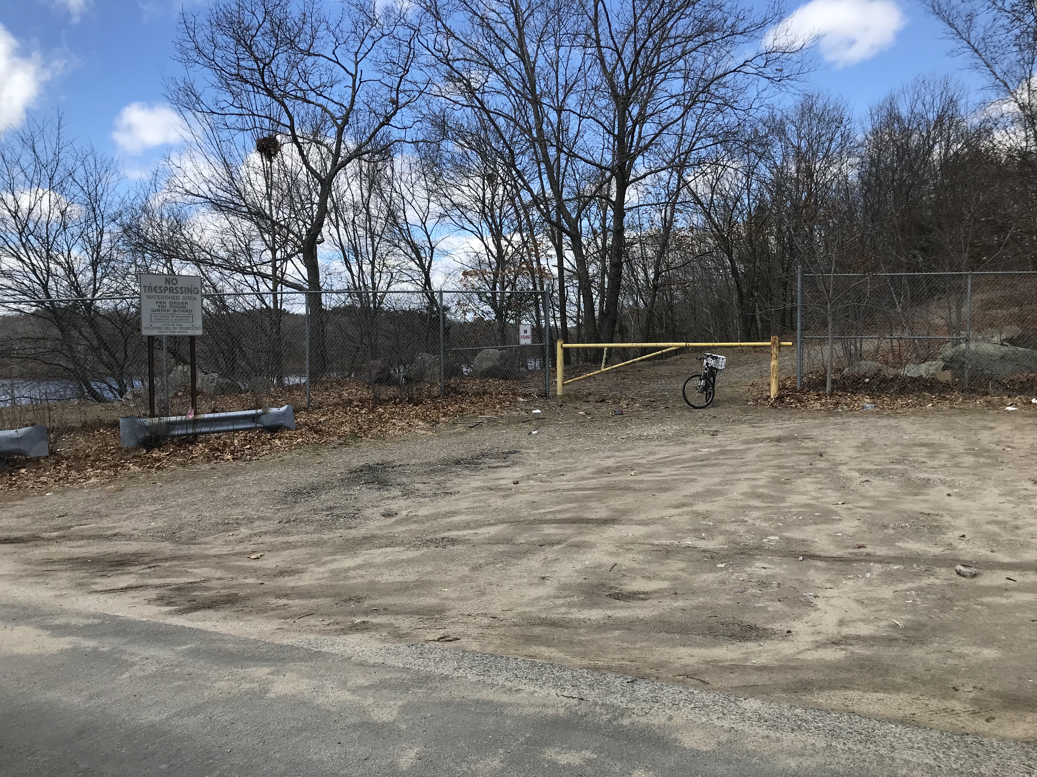
Point D: Randolph side of dam
There are two ponds, separated by this dam. It is part of the Reservoir Walk and you can freely walk to the Braintree side of the dam.
The Braintree border is about halfway across, and the Randolph Reservior Walk ends there. The gate is intended to keep vehicles off the dam.
|
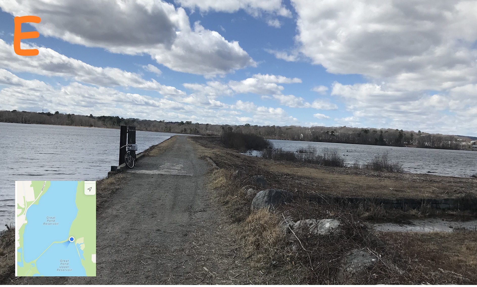 |
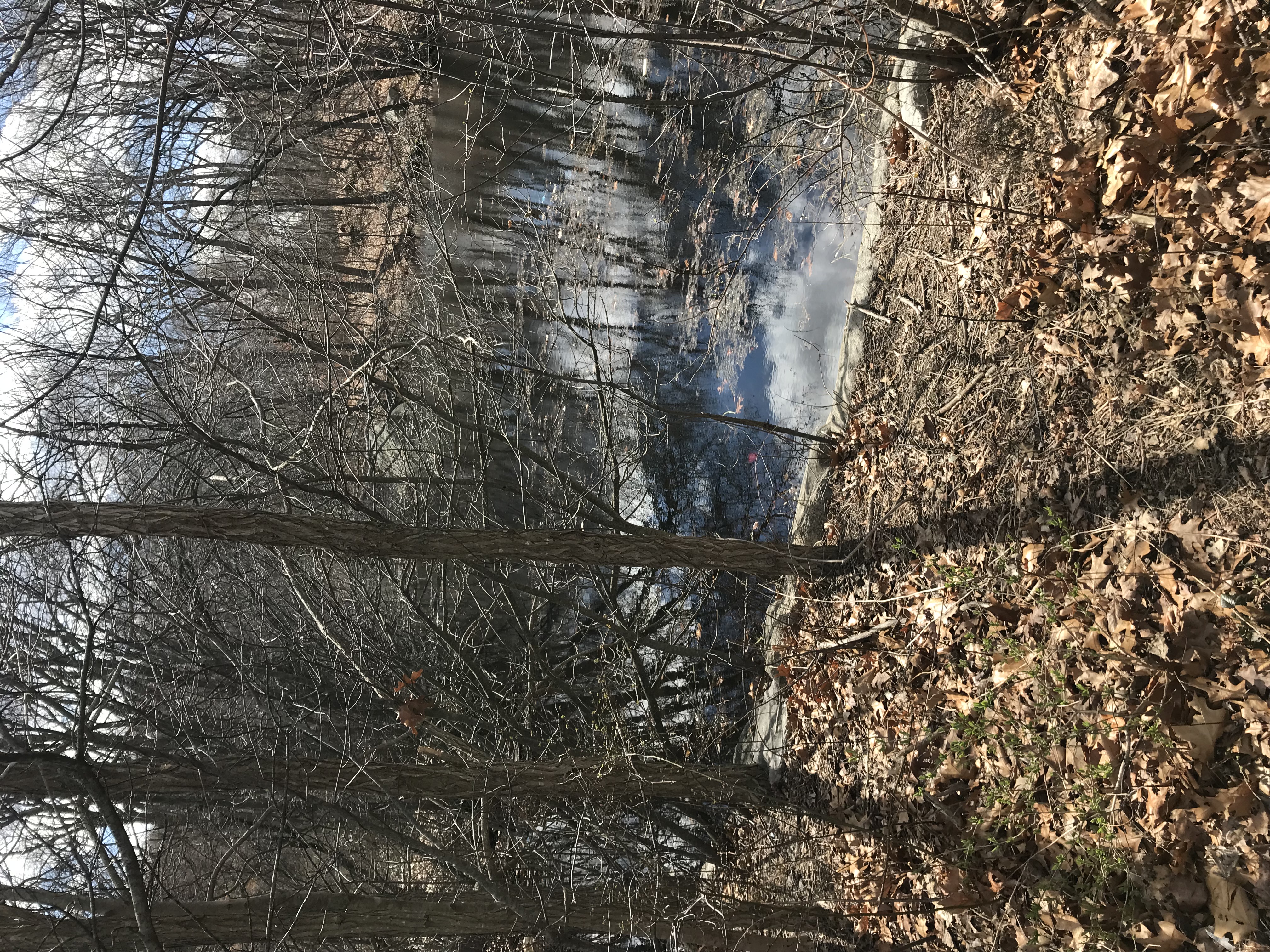
Point E looking west: Braintree side of dam
Looking back into Randolph from the Braintree (east) side of the dam, one can see dam controls on the north side (water flows through the dam there).
There aren't any "No Trespassing" signs to get to this point from Randolph, but there ARE "No Trespassing" signs to get here from Braintree (if you enter on King Hill Street). Many Randolph residents are working with the Town of Braintree to remove those "No Trespassing" signs and open up the Reservoir Walk to circumnavigate the entire reservoir. Your input would help!
|
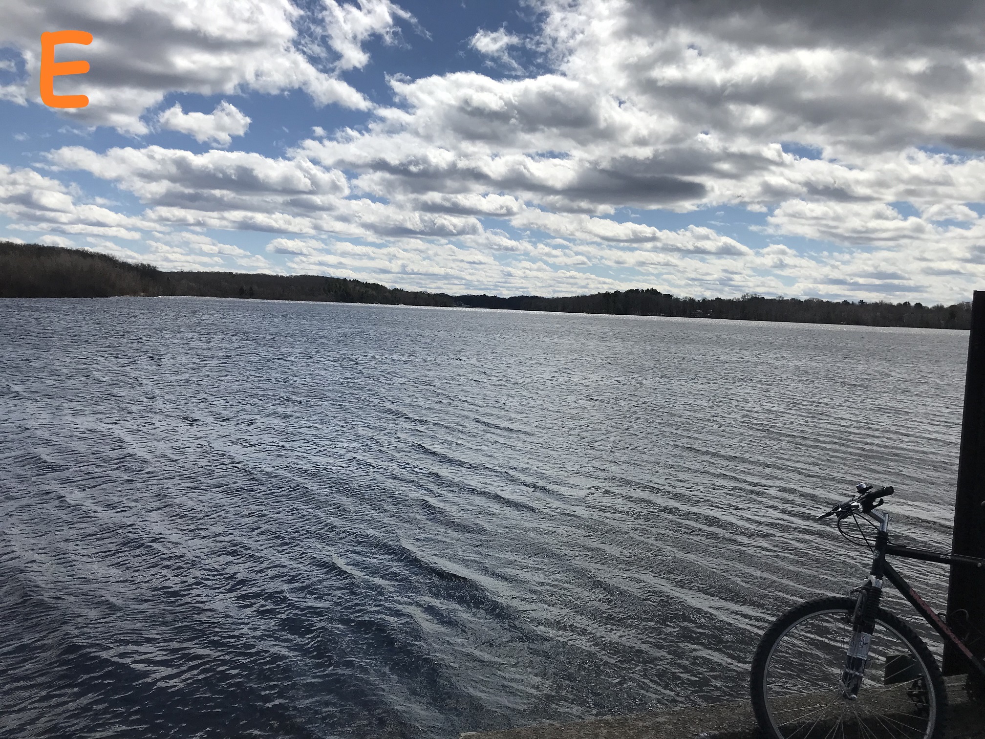 |
Point E looking south to Oak Street
This is the same point, with the bicycle in the same spot, looking south instead of west.
If you zoom in, you can see some homes that are on Oak Street in Randolph -- that street defines the southern edge of the reservoir.
Note that the Town of Braintree does not maintain this section of the trail around reservoir (from the dam to the Randolph border), because they don't encourage recreational usage like Randolph does. Therefore it's a wet mess -- after rain, or in spring, you're likely to get your shoes wet and muddy.
|
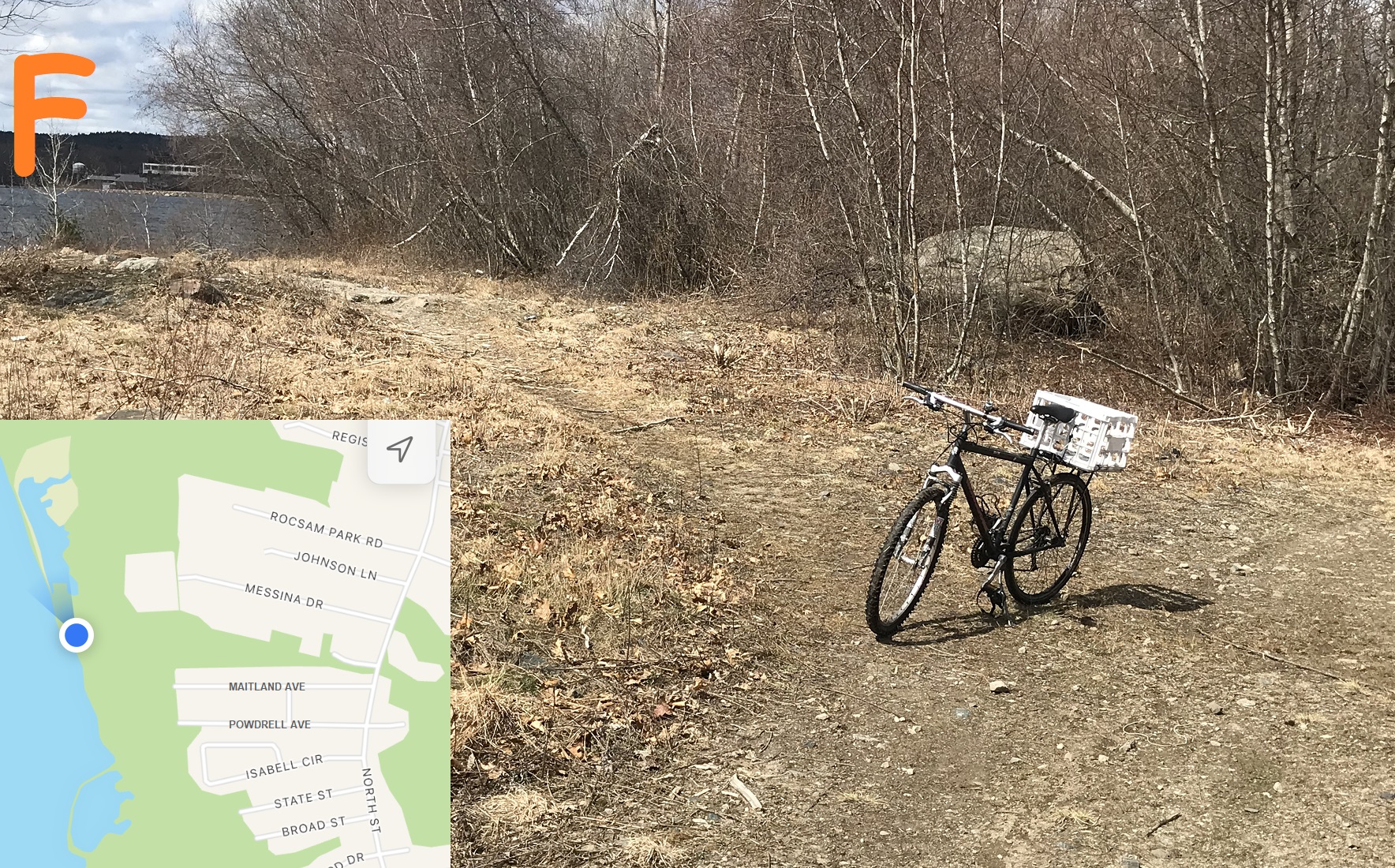 |
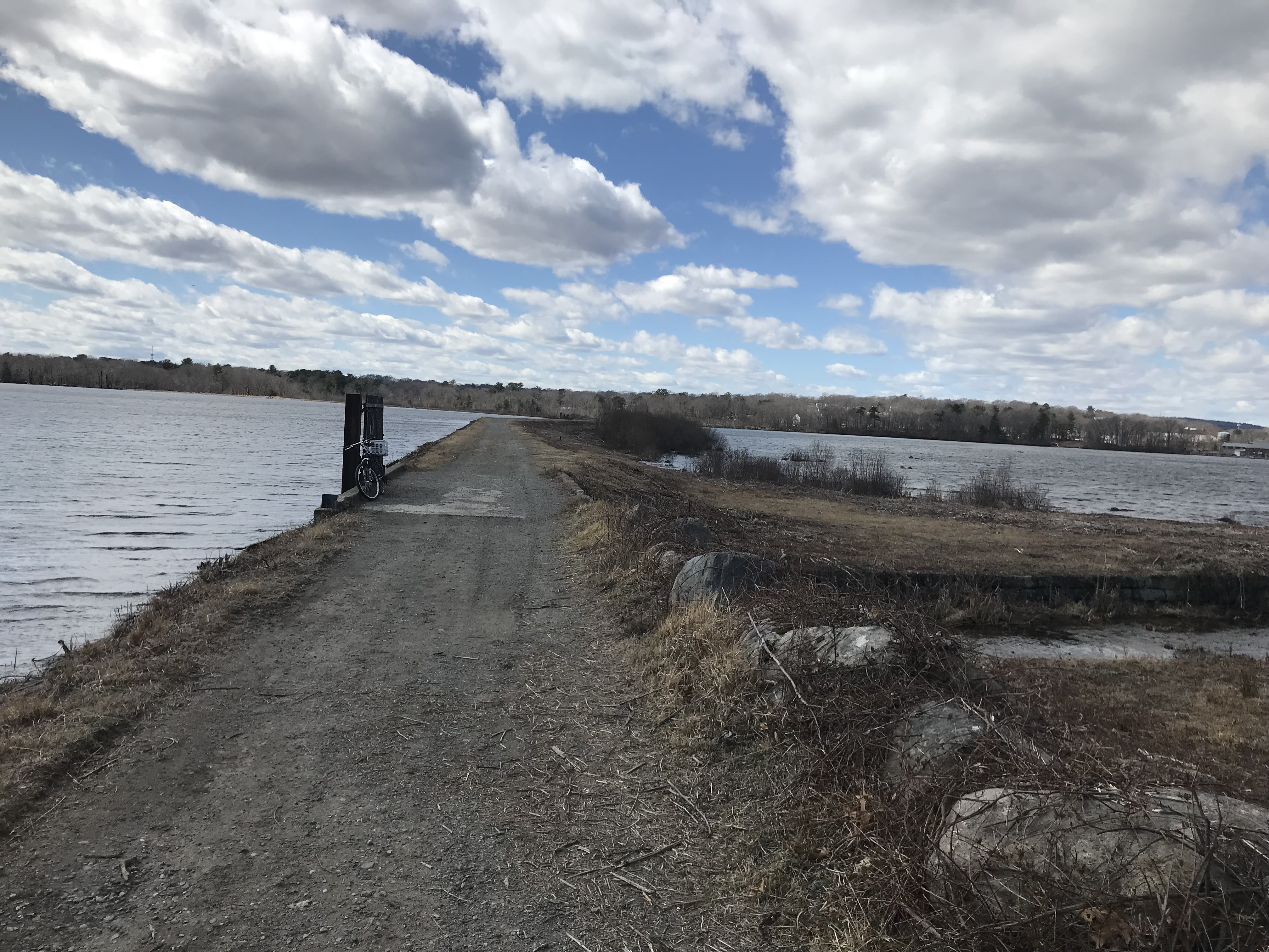
Point F: Randolph-Braintree border
This spot is on the border between the two towns -- ont he inset map, Messina Drive is Braintere and Maitland Ave is Randolph.
You CAN get to this point without encountering any "No Trespassing" signs if you come over the dam, but it's Braintree, not Randolph, so it's not actually the Randolph Reservoir Walk from the dam to this point. You can see the Randolph-Holbrook water treatment plant way across the water at the left top of this photo. The bicycle is along the main trail and there's a "spur" to the water's edge.
You can complete a "figure 6" around the reservoir without encountering any "No Trespassing" signs -- but Randolph activists are working with Braintree activists to make it a "figure 8". Maybe by 2025 when the new plant opens, if you add your voice!
There ARE entrances from, Messina Drive and other Braintree streets -- without "No Trespassing" signs -- and replacing those with "Welcome" signs would make our reservoir a lot more open and accessible -- this point is basically the northern entrance to the Randoph Fin-Fur-Feather Conservation Area (it doesn't quite reach the Braintree border now).
|
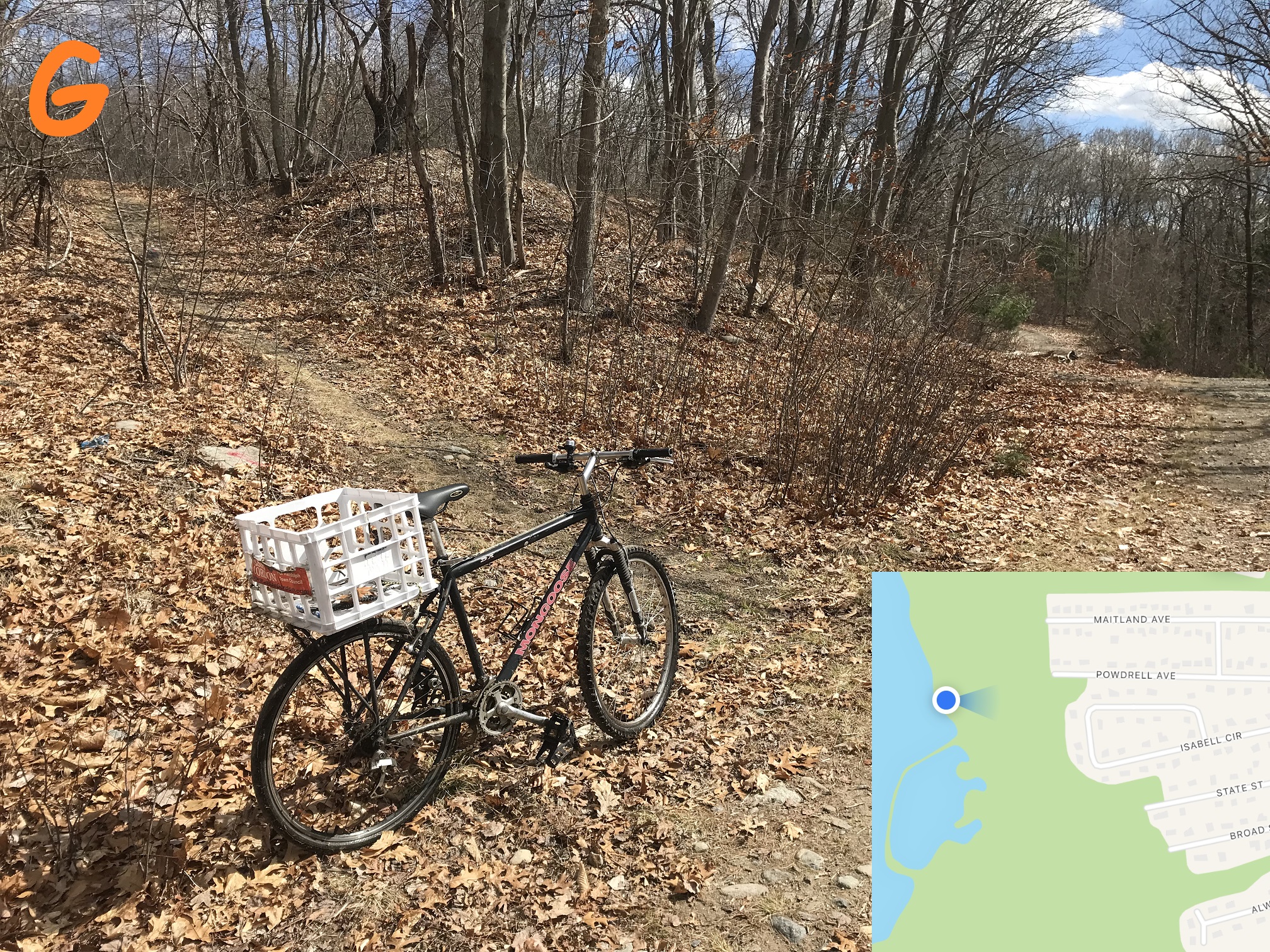 |
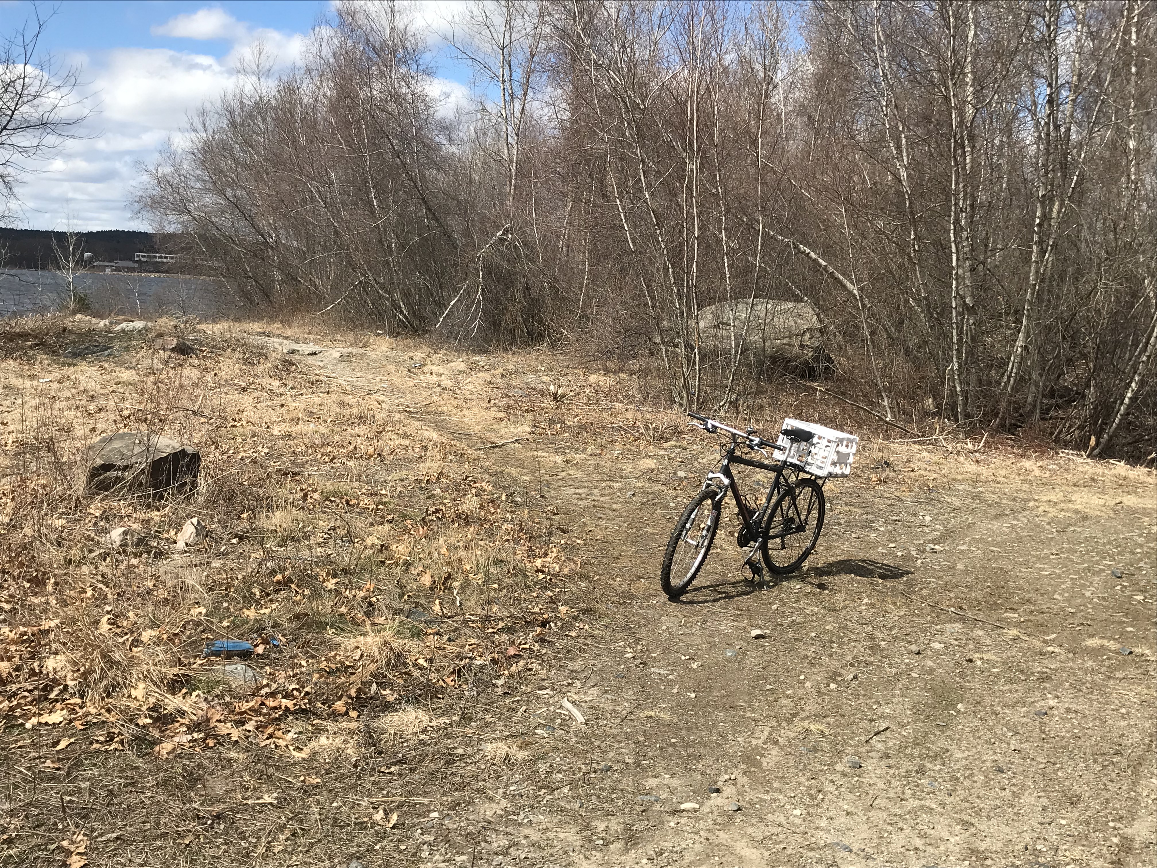
Point G: Fin-Fur-Feather Conservation Area
The Fin-Fur-Feather Conservation Area stretches from several streets along North Street to the reservoir's edge. (North Stre in Randolph becomes Pond Street in Braintree).
There are numerous foot trails like the one shown, which go east to each of the streets along North Street.
The bicycle points south along the main trail, and to its east is Powdrell Street and Isabell Circle.
From the North Street side, you can enter each trail only by foot -- there is no parking no those side-streets.
The Fin-Fur-Feather Conservation Area is rough hiking or biking -- wet and muddy if you go off the main trail -- but the main trail is maintained by the Town of Randolph and hence less rough once south of the Braintree border.
|
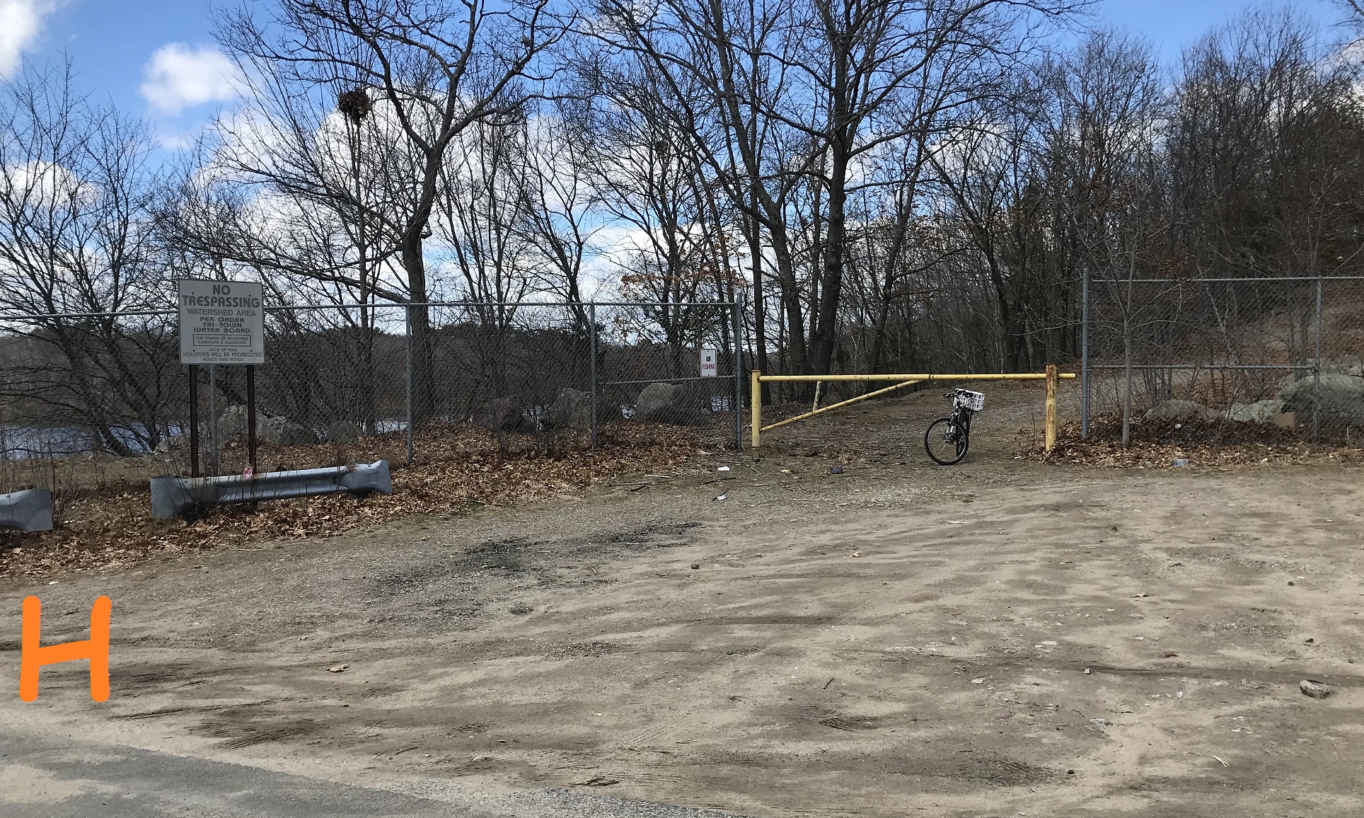 |
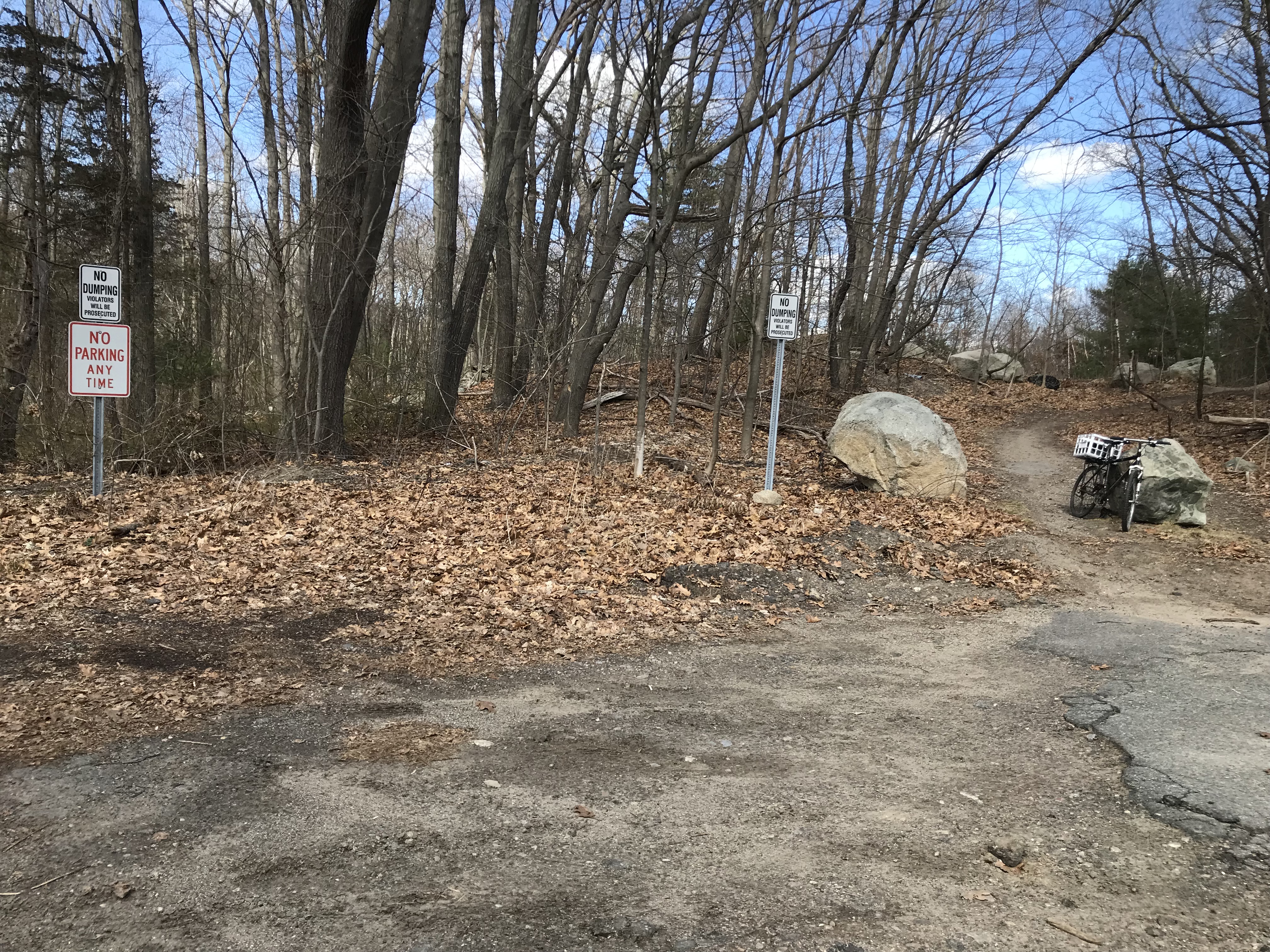
Point H: Oak Street parking
This parking area is on Oak Street on the east side of the reservoir. You can legally park here (the yellow gate is to prevent vehicle access to the main trail).
The new "Welcome" sign will replace the "No Trespassing" sign shown -- that is the last "No Trespassing" sign on the Randolph side of the reservoir (there are some left in Braintree!)
|
 |
|
2023 note: We tried to place a "Welcome" sign at the Oak Street Parking but the Commonwealth of Massachusetts said, in a 1950s-like paternalistic tone, "Oh, no, one must not park so close to a reservoir, and we, The State, control that patch of land even though it's in Randolph." Our more sensible Randolph police assure me that they would never ticket anyone for parking here. For now, no "Welcome" sign -- go west to the other Oak Street entrance. We'll fix this 1950s mentality in 2024!
|
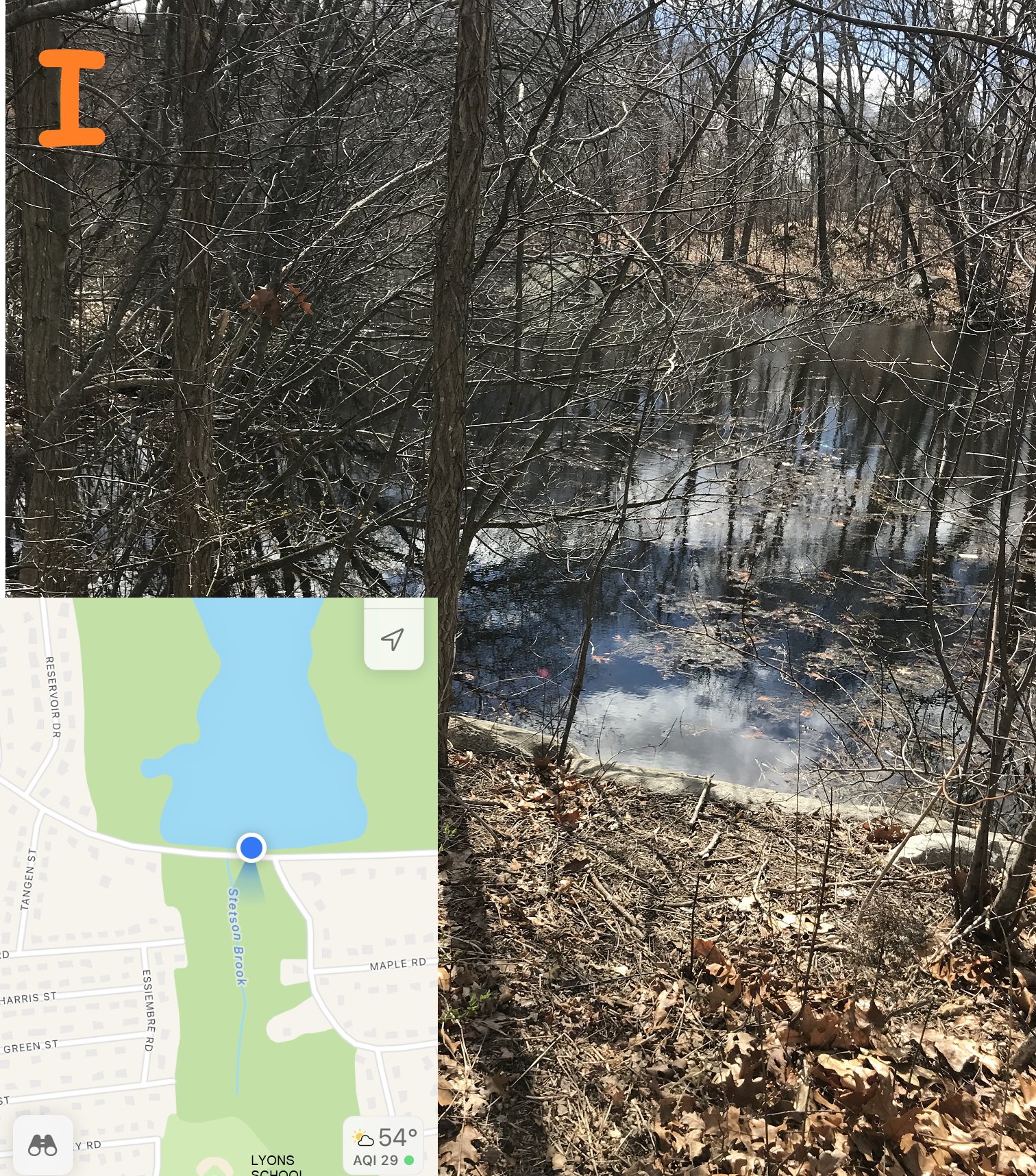
Point I: Stetson Brook
Looking south from Oak Street across the street from the reservoir is Stetson Brook, which is inaccessible but legal fishing as reported on fishing review websites.
Randolph includes a conservation area along Stetson Brook which allows walking to the Lyons School (the old school scheduled to close in 2024, on Lee Farm Road). Stetson Brook is not maintained well -- you'll see a lot of trash -- but perhaps this could get added to the Reservoir Walk in future years.
|
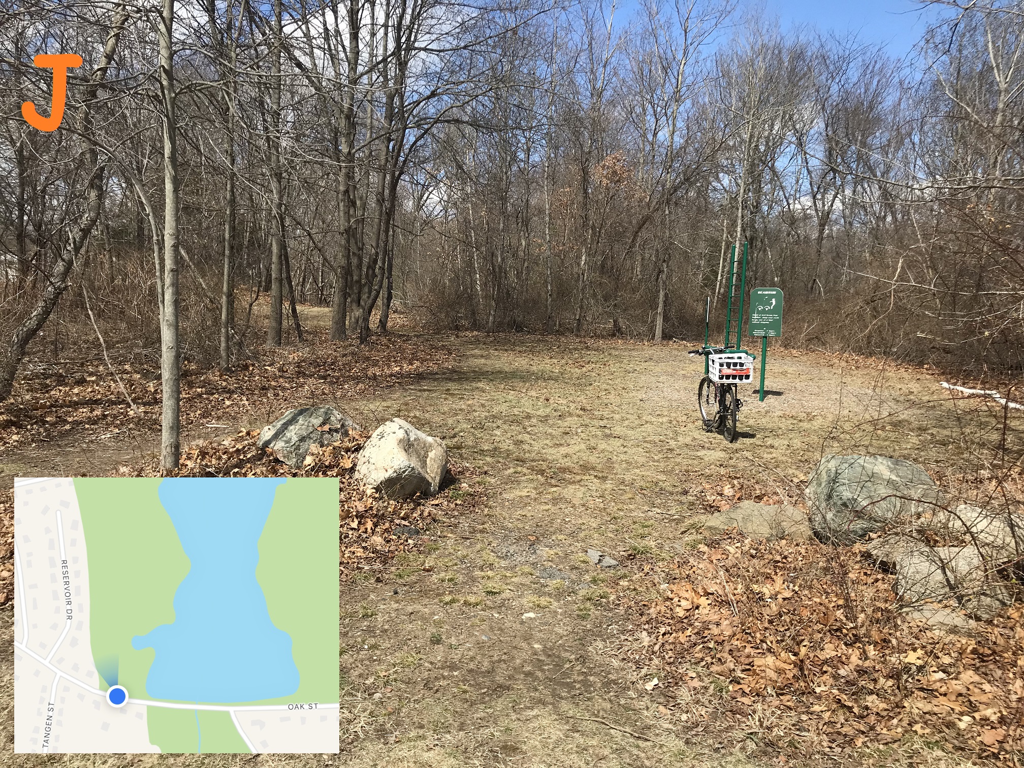 |
Point J: south Workout Area
This workout area is visible from Oak Street on the west sied of teh reservoir, but you have to park on the east side of the reservoir to get there.
At the back of the workout area is a gated entrance to the Reservoir Walk on the west side of the reservoir. If you proceed north on that main trail, you get to the north workout area shown above in point B.
You have to walk along Oak Street to connect the "bottom of the figure 6" from the trail east of the reservoir to the trail west of the reservoir (this entrance). Another project -- maybe planned in 2023 and underway in 2024 -- will make a pedestrian trail taht conencts the two halves (and maybe some connection to Stetson Brook too).
|
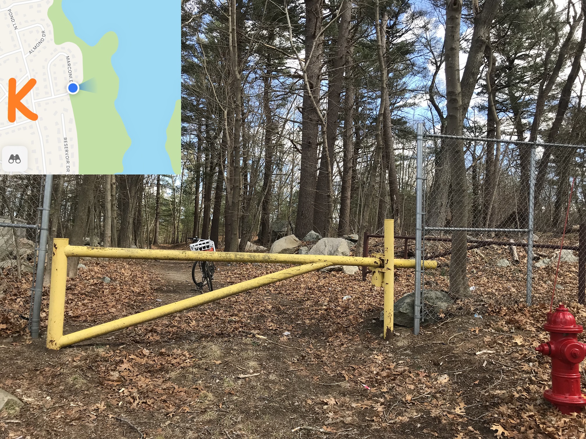 |
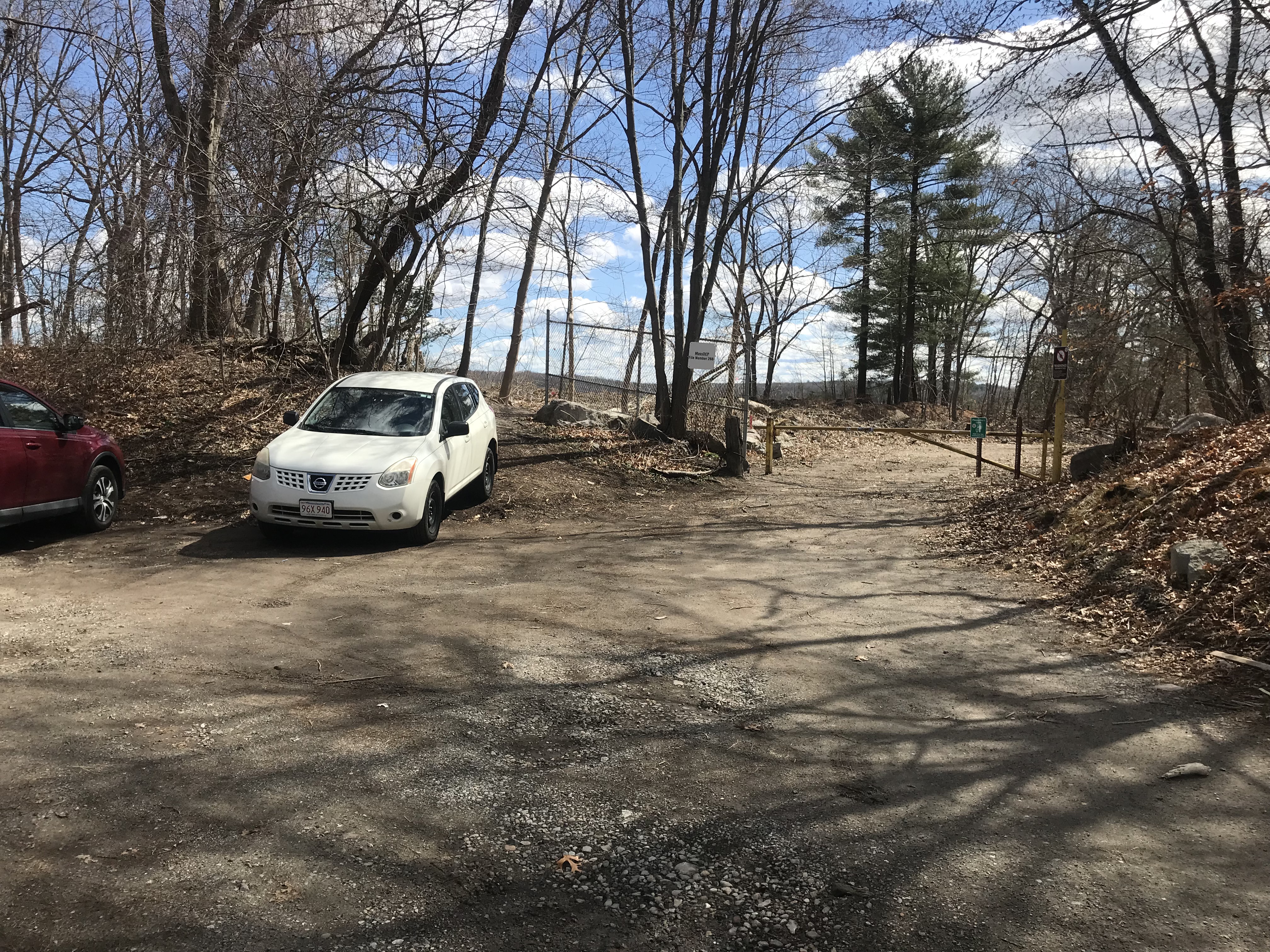
Point K: Marconi Drive entrance
Just about every street adjacent to the reservoir walk has a foot entrance -- Marconi Drive has a large entrance to allow in DPW vehicles when needed. This is all town-owned land -- it's fine to climb over or under the car barrier -- and there's a second barrier to the right (it's brown and perpendicularly behind the yellow one).
The bike points on the trail to the reservoir -- there are a network of paths in this area but please try to respect people's property by staying on the town side of the property line (The Marconi Drive entrance has some private property fenced off, but many are just open).
|
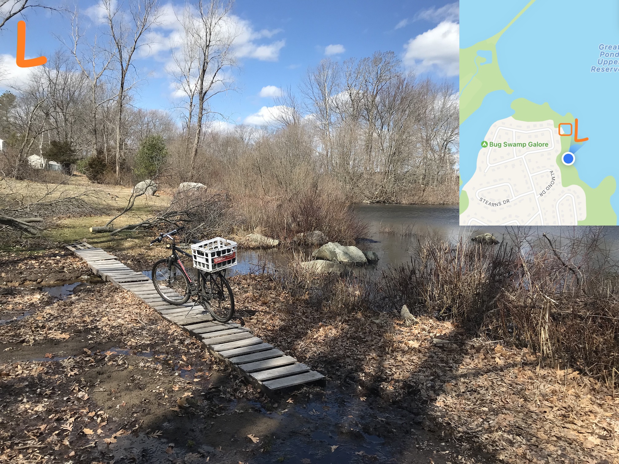 |
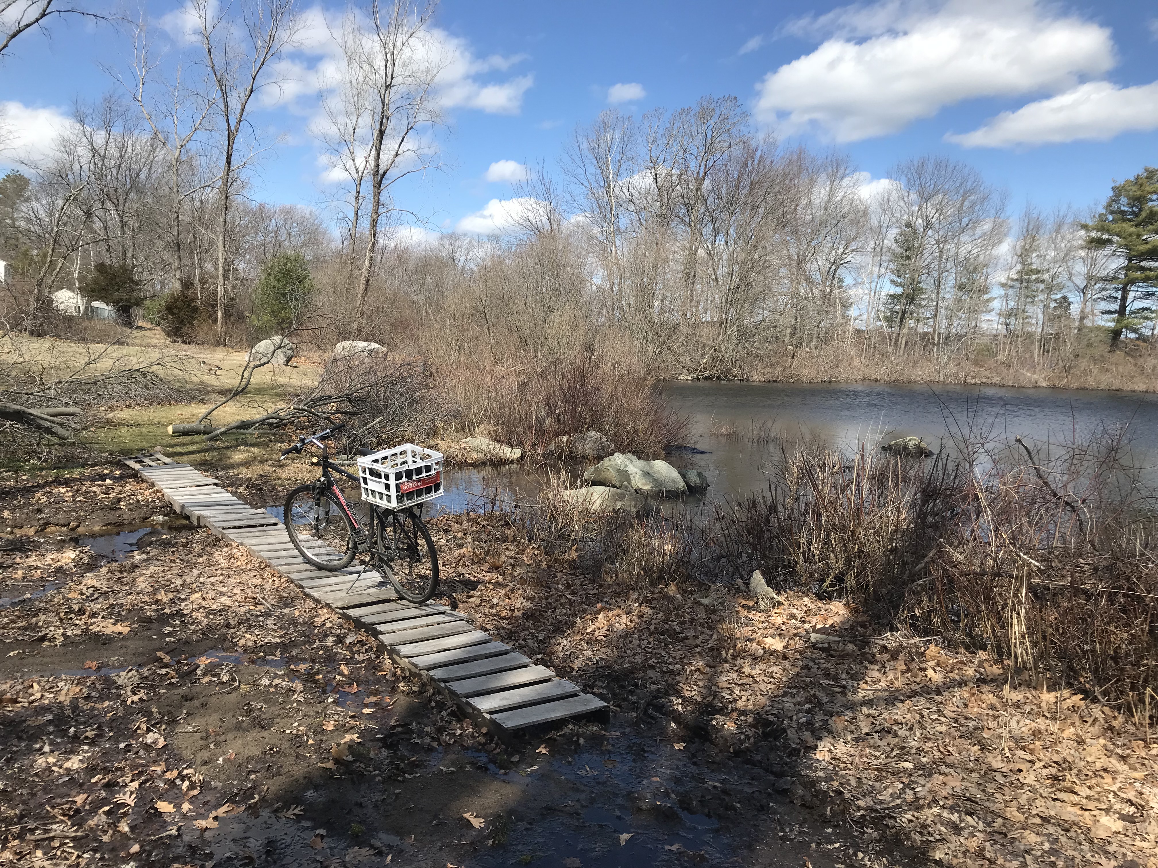
Point L: Norroway Brook
The trail is wet (sometimes with running water) in this area where Norroway Brook enters the reservoir.
Norroway Brook is where Norroway Pond in Powers Farm drains -- you can see it exiting towards the Higashi School near the boardwalks on the north side of the park.
There's a boardwalk here too, but it's maintained by the neighboring resident, not by DPW. This property touches the reservoir (when the reservoir is full!) so please respect the property owner's generously allowing people on the Reservoir Walk to cross (i.e. try not to track mud onto their lawn!)
|
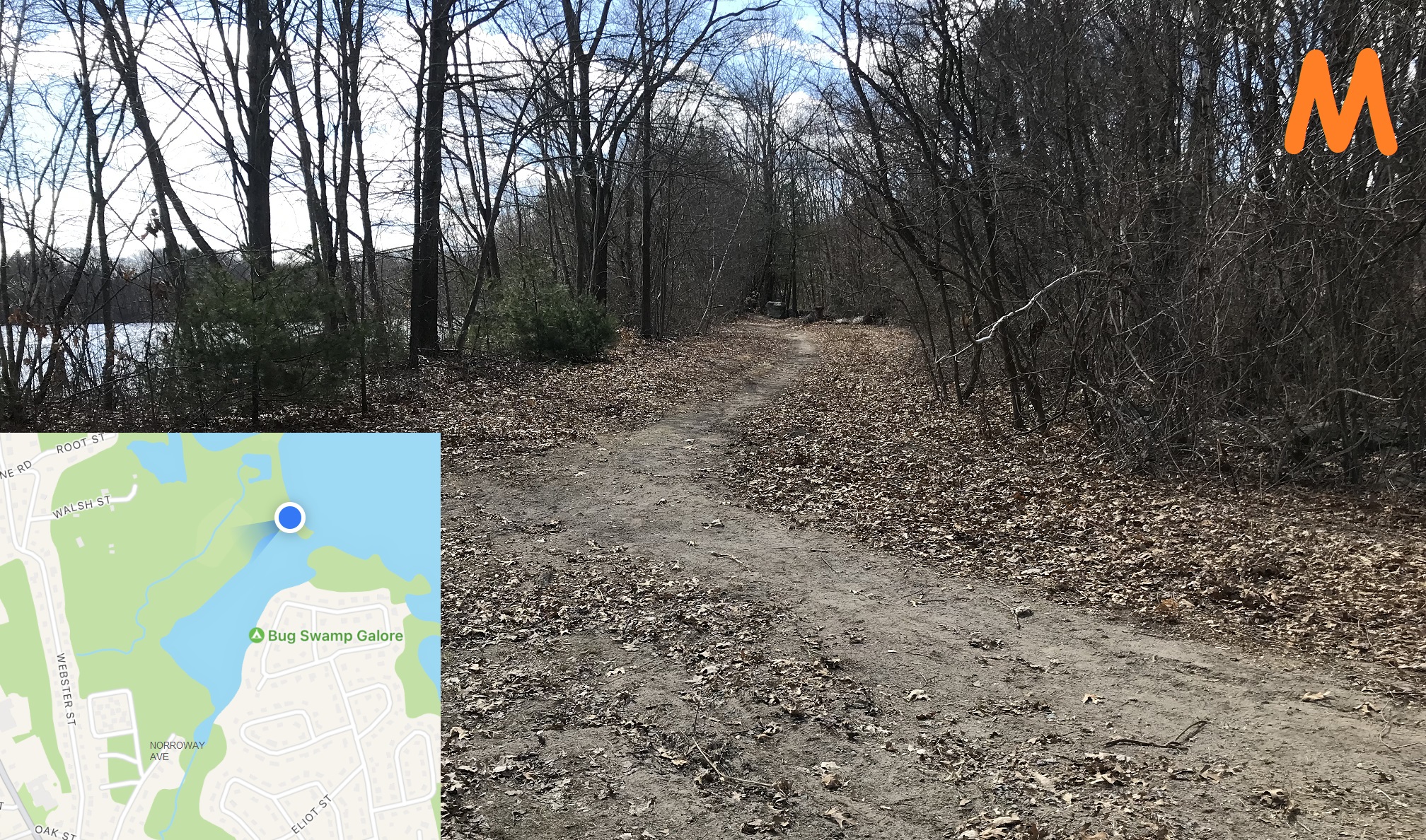 |
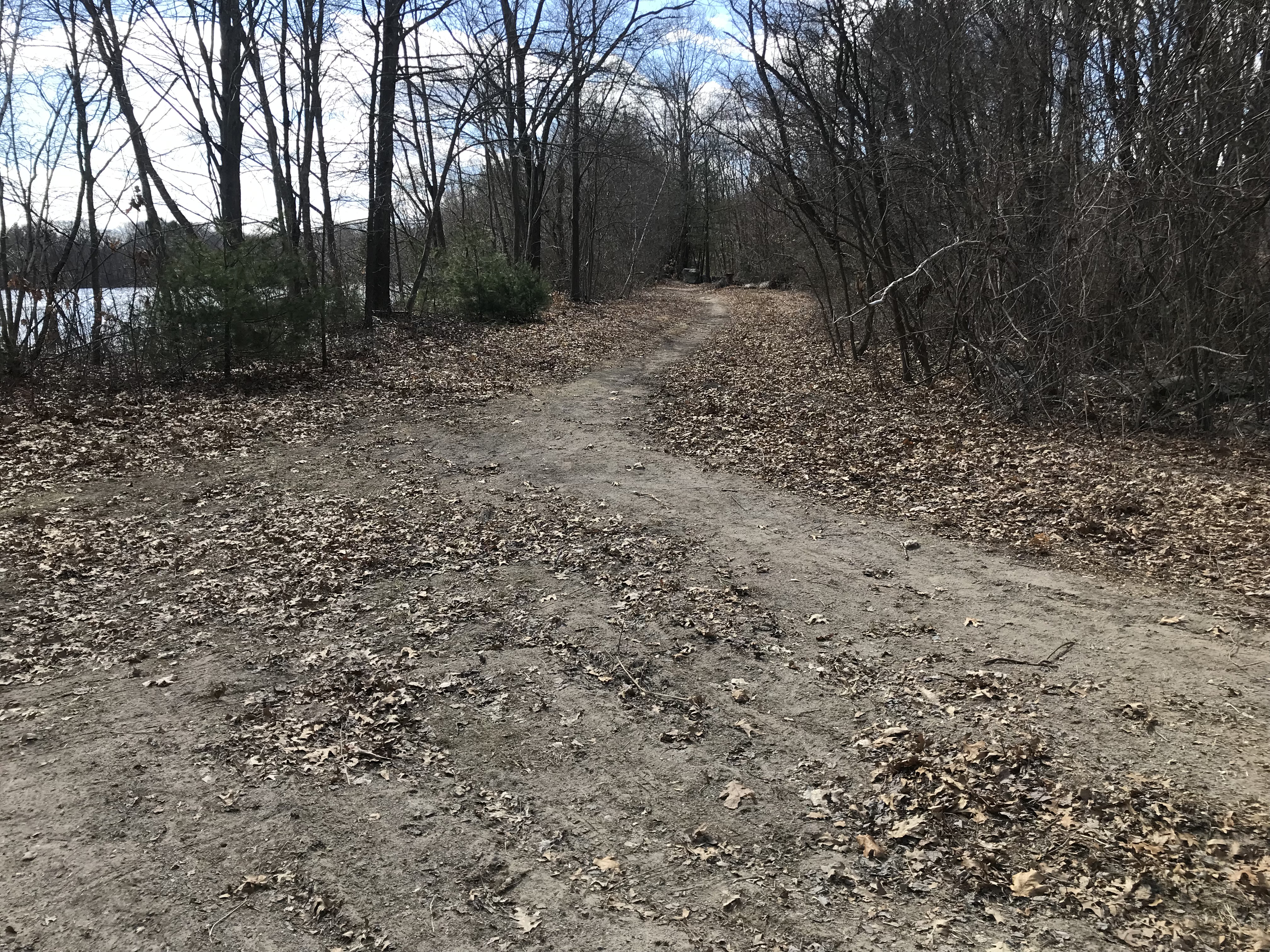
Point M: Norroway Avenue trail
If you proceed north on the path at this split, you get to point D which is the west side of the dam.
The side trail leads along Norroway Brook to Norroway Avenue.
|
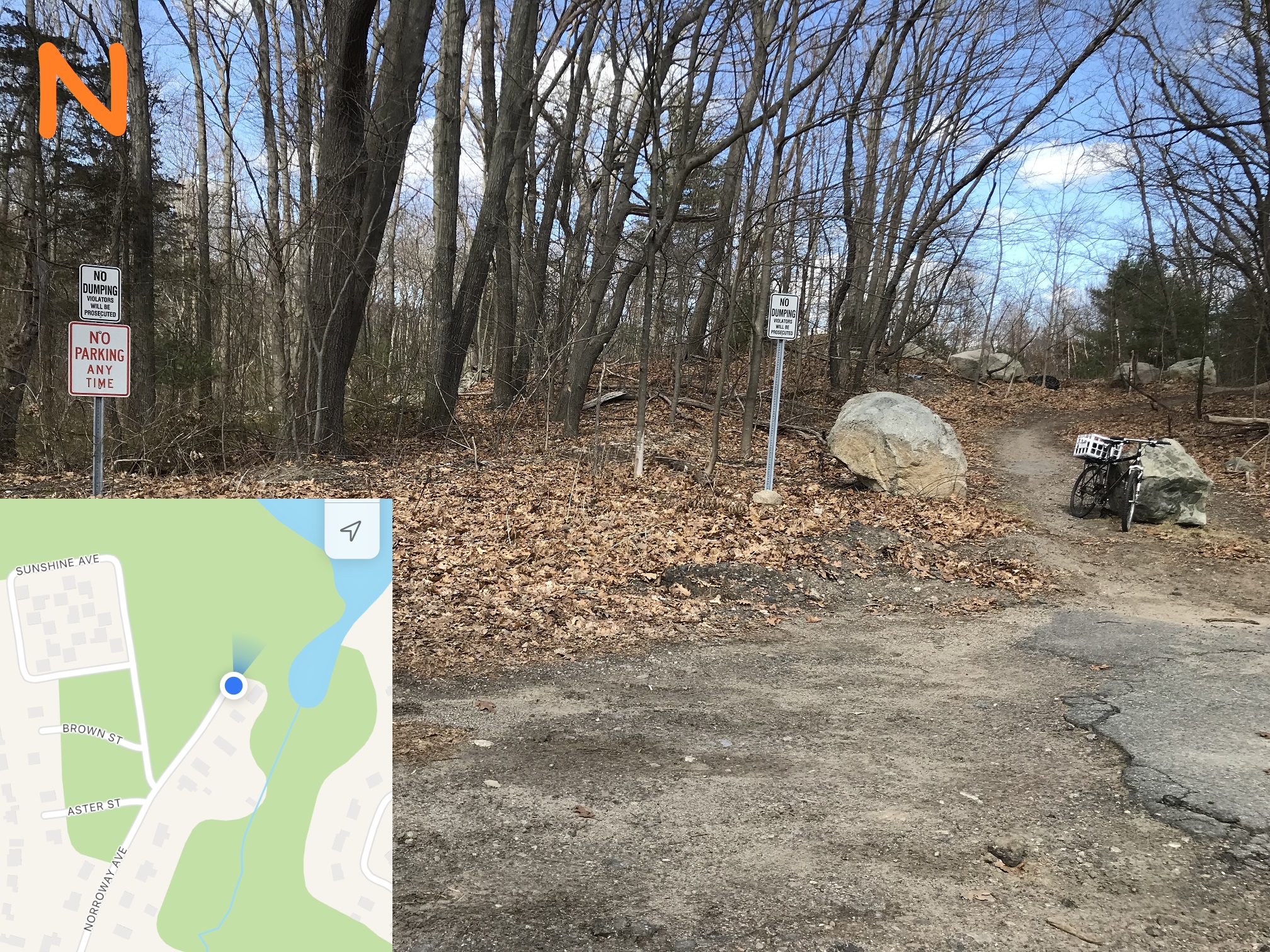 |
Point N: Norroway Avenue dead end
Norroway Avenue is a dead end that lets directly onto the trail shown to point M.
There's no parking here, but it is within walking distance of the George Welch Senior Housing on Sunshine Avenue, and the Francis Crossing Apartments at the corner of Oak Street and North Main Street.
|